
Map of Ireland
Map of Ireland > Ireland Locator Map • Ireland Travel • Ireland Relief Map • Dublin Map
 The Irish Republic is located on an island at the western edge of
Europe. It can be best described as a large lowland region
surrounded by a broken rim of low mountains. It is bordered by the
Atlantic Ocean to the west, by the North Channel and
Scotland to the northeast,
by the Irish Sea and England to the east, and by Saint Georges Channel
to the southeast. With its lush vegetation, mild climate, and
frequent rainfall, Ireland has earned the nickname Emerald Isle.
The Irish Republic is located on an island at the western edge of
Europe. It can be best described as a large lowland region
surrounded by a broken rim of low mountains. It is bordered by the
Atlantic Ocean to the west, by the North Channel and
Scotland to the northeast,
by the Irish Sea and England to the east, and by Saint Georges Channel
to the southeast. With its lush vegetation, mild climate, and
frequent rainfall, Ireland has earned the nickname Emerald Isle.
Ireland occupies an area of 27,135 square miles; its capital city, Dublin, is situated on the Irish Sea coast.
Ireland Map, Showing Major Cities and Counties

Geography of Ireland
While the lowlands comprise mostly peat bogs, the uplands include the Mountains of Kerry which has Ireland's highest peak, Carrauntoohill. Ireland's longest river, the River Shannon, runs through the lakes of Allen, Ree, and Derg. Most of Ireland's land is used for pasture for its booming farming industry, which supports cattle, sheep, and pigs. While some of Ireland's land is also used for crops, it is a relatively small percentage. Forests are relatively sparse in Ireland, and cover only about five percent of its land.
Ireland's Climate
Ireland is known for its damp climate, and it rains throughout the year. The country's mild and damp climate is the result of the Gulf Stream influence that warms the west. The weather in the east, where Dublin is located, is a bit cooler.
Leading Irish Cities
Dublin, Ireland's capital and largest city, is a leading European cultural and tourist destination. It sits at the mouth of the River Liffey on Dublin Bay. Frequently visited sites in Dublin include Christ Church Cathedral, St. Patrick's Cathedral, Trinity College, and Abbey Theatre.Cork is Ireland's second largest city; the picturesque center of town is located on an island in the Lee River. Galway, a university town located on Galway Bay in western Ireland, is noted for its festivals and nightlife.
Ireland Travel Information
Ireland is famous for the green shamrock, potatoes, and lively Irish music. Visitors to Ireland enjoy golfing, horseback riding, and cycling, as well as other sports and activities. Carrauntoohil, Ireland's highest point, with an elevation of 3,415 feet (1,041 meters), is frequently visited by tourists as well.
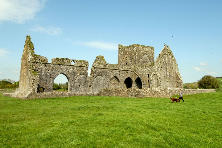
The Irish landscape is naturally beautiful and resonates with a tangible sense of history. Tranquil green pastures and mountain retreats, magnificent cliffs overlooking the western coastline, quiet sandy beaches, and remote offshore villages all await the visitor to Ireland. There are also many ruins dotted throughout the country, including the famous Hore Abbey ruins located at Cashel, County Tipperary. The Irish people are friendly, and traditional Irish culture and language survives to this day, especially in some of the more remote regions of western Ireland.
For more information about Ireland, visit the Government of Ireland website and the Ireland Citizens Information website.
Irish Tourism
- Tourism Ireland - Official guide to visiting Ireland includes holiday and golf information.
Ireland Resources
- CIA - The World Factbook - Ireland - US Government almanac provides Ireland maps, geography and statistics.
- Wikipedia - Ireland - This free online encyclopedia includes information about Irish history, regions and geography.
- Ireland News - News headlines and news article links about current events in the nation of Ireland.
Related Map Website
- Map of UK - map of the United Kingdom.
All rights reserved. About us.
Certain maps hereon are © Map Resources.